目次
The Long History of the Ancient Holy Grounds on Takegashima
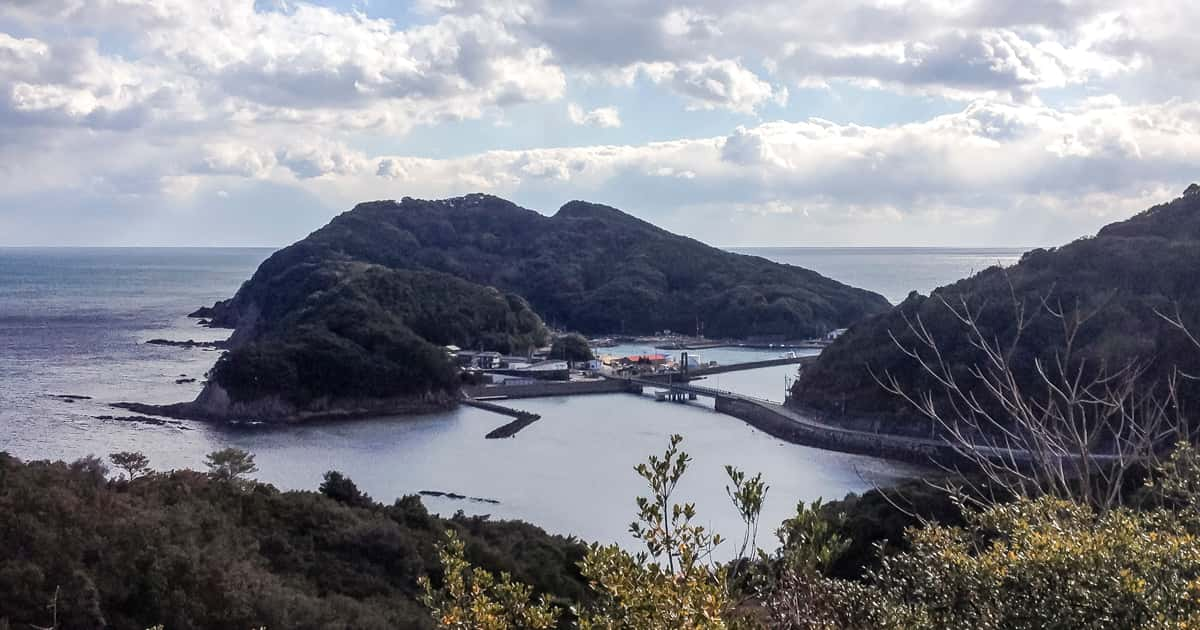
The small island of Takegashima is located off the coast of Kaiyo Town in the Muroto Anan Kaigan Quasi-National Park, which is in the southernmost tip of Tokushima Prefecture. Connected by a short bridge of about 100 meters, anyone can easily come and go as if the island is part of the mainland. The size of the island is about 1 km from North to South, 700m from East to West, and the area is about 0.4 km2. The circumference of the island is about 4 km, and the surrounding waters are known for the live colonies of coral reefs which are called ishi coral. Takegashima has a port that serves as a base for tuna fishing, and fishing is the main source of income for people living there. In addition, the northwestern area is protected by Takegashima Marine Park and Marine Jam, which are operated by Kaiyo Town. The town offers various tourist attractions such as sea kayaking and sight-seeing tours in boats with underwater glass windows.
Takegashima
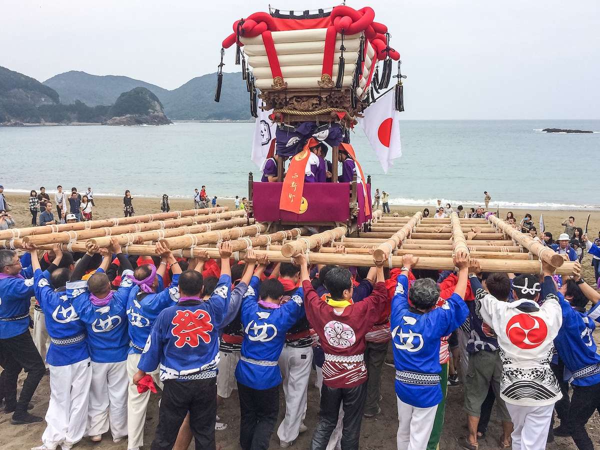
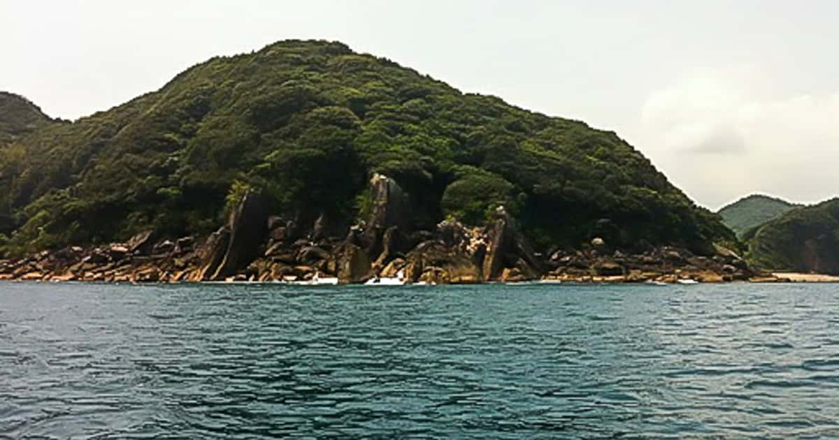
The Rocky Eastern Shores of TakegashimaToday, the population in Takegashima is rapidly declining. There are not enough young people to carry the portable mini mikoshi during the festival season. Recently, the townspeople are facing great difficulty in continuing the Marine Mikoshi Festivali or “Kaichu Mikoshi Matsuri ”. In 2017, the Marine Mikoshi Festival event was unfortunately canceled.
The long tradition of the Marine Mikoshi of Takegashima, most likely started from a historical interaction with early Israelite travelers. Some Japanese believe that the Arc of the Covenant was brought to Japan by a ship. When it was carried out of the ship to land, people had to walk into the ocean water and carry it on their shoulders. Young people today continue to carry the heavy mikoshi even when the sea is frigid cold so they can celebrate and worship the gods in the same way that their ancestors did.
Topography of Takegashima
It is not well known to anyone who is not local to the island that Takegashima is a revered ancient holy ground. Because this area is just a small island in Shikoku, Takegashima may have been quietly protected by the descendents of the first settlers on the island without the Japanese mainlanders knowing a lot about its historical background. Although this small island doesn’t seem to be anything out of the ordinary, the reason why Takegashima secretly attracted attention in ancient times is due to its unique topography and the original appearance of the island out at sea.
The Unique Shape of TakegashimaLong ago, many ancient people who came to the Japanese islands from the Asian mainland came mostly by way of the Ryukyu Islands from Taiwan by ship first and then they traveled North to the Nansei Islands. These ancient sailors also sailed from Kyushu to Awaji Island and Honshu via the southern coast of Shikoku. Sailors then began to closely examine rest stops around the archipelago that had the right terrain and the wide view suited for becoming the base of the new world, and they saw this island as a place to also build shrines to worship God. Before long, many more bases were built throughout the archipelago as sailors searched for new islands to inhabit. These sailors used fairly advanced technology to navigate the waters around the Japanese islands, and there is some evidence to suggest that their advanced astronomy skills and technology came from the distant Asian continent, more specifically the West Asia region.
Awaji Island was the birthplace of Japan as is clearly stated in the CHRONICLES OF JAPAN and KOJIKI and this island is also geographically located at the center of the Japan archipelago. In addition, the archipelago that floats on the Kuroshio Current in the Nansei Islands ends at Awaji Island. Since it was impossible to sail further north from there, Awaji Island was the final destination of the “islands of the sea” on the Kuroshio Current. Needless to say, the ship route that ran from the Nansei Islands to Awaji Island, and the ship route that ran from the southern coast of Kochi Prefecture to the Kii Channel to Awaji Island via the eastern coast of Shikoku have been regarded as an invaluable routes for the migrants traveling north.
Sunrise over Takegashima seen from
Toujingahana in Kannoura on the vernal equinoxAncient travelers used many landmarks that could be seen from the sea as they traveled and determined their movements by following astronomy. Among these markings, Cape Muroto in Shikoku was especially important. The direction of the sun rising during the summer solstice from Cape Muroto faces the summit of Mt. Fuji. Three bases are connected through a lay line that runs through Cape Irako, Ise Jingu Inner Shrine, and Odaigahara. In addition, at the direction of about 240 degrees from Cape Muroto is where the sun sets on the winter solstice. Cape Ashizuri and Sakurajima Ontake in Kagoshima are also in alignment with the lay line. Cape Muroto was an important landmark for ancient voyagers who traveled according to the celestial bodies in the sky and the island topography. Therefore, using Cape Muroto as a starting point, sea travelers were able to confirm the position and the direction each base faced in the archipelago.
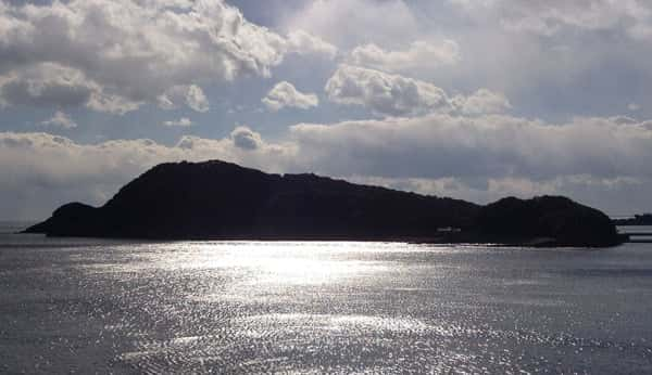
Heading north from Cape Muroto, it is thought that the next useful travel post was Ishima, which floats at the easternmost tip of Tokushima. From Ishima, Awaji Island is not only visible, but the summit of Mt. Tsurugi in Shikoku, the second highest mountain in West Japan, is also visible in the distance along with the mountains of Kumano to the East. Also, north of Ishima is the Stone Treasure Hall of Oushiko Shrine, which is said to be one of the three natural wonders of the world. It is possible that the location of the Oushiko Shrine was found to have been linked to Ishima. When sailing along the coast from Cape Muroto to Ishima, one can see that both bases are nearly 100 km apart. The route that connects via the Kii Channel has a good view, and the shipping route from the Kochi coast to Setouchi Island by way of Awaji Island was gradually settled along this line.
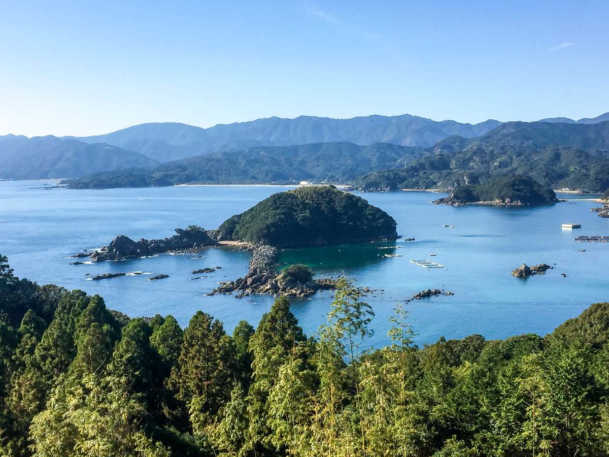
The View of Kuzushima and Kochi Prefecture
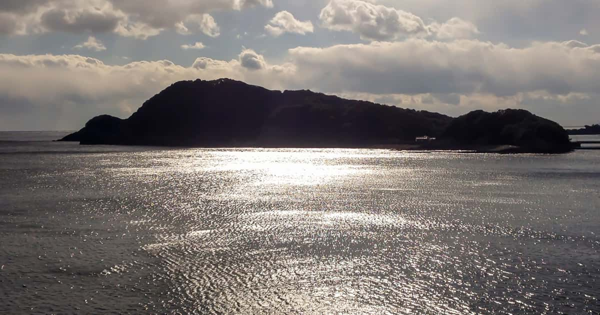
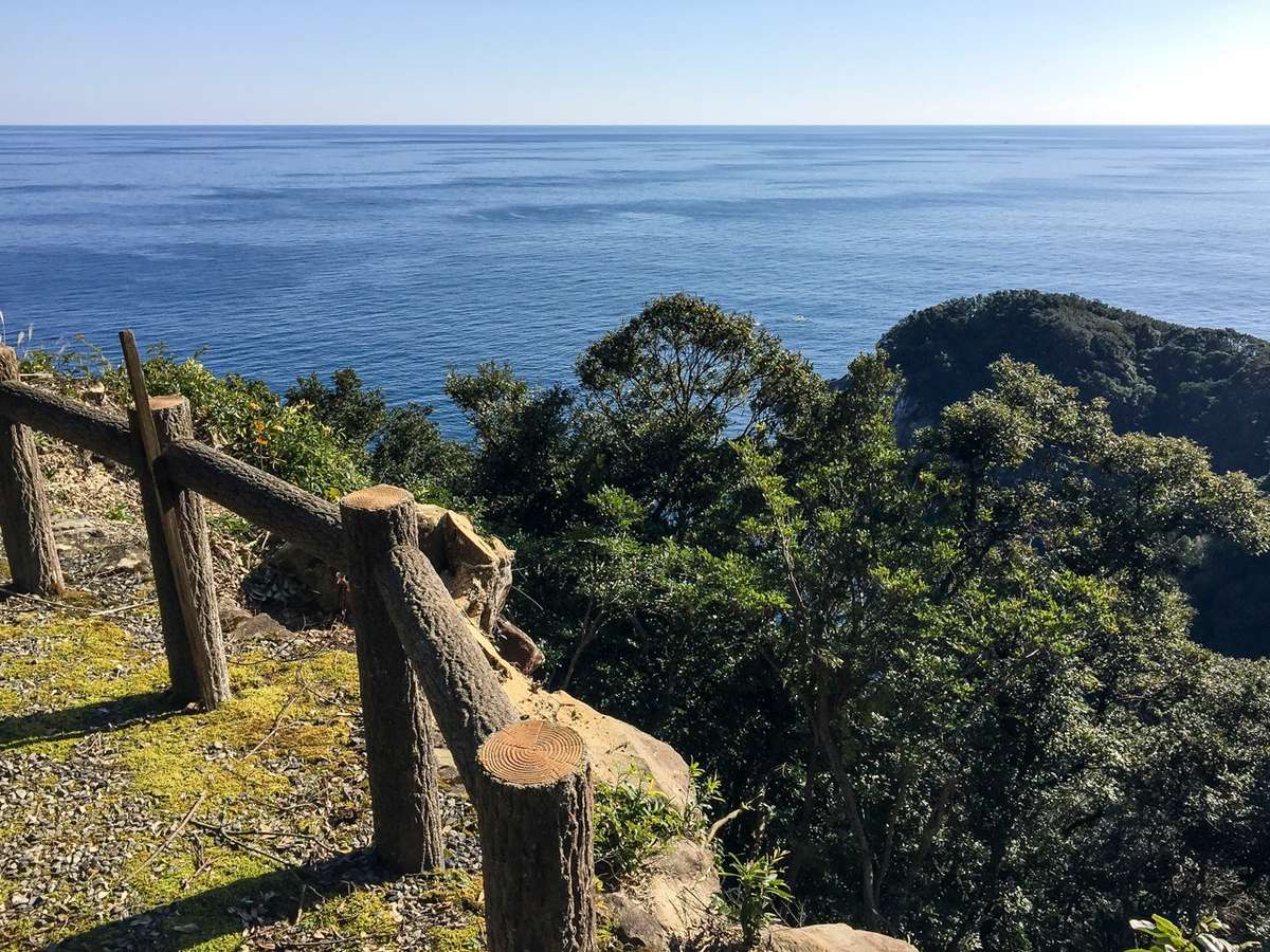
from near the summit of TakegashimaSailing North along the Pacific coast of Kochi and Tokushima prefectures, Takegashima Island is visible 35 km north of Cape Muroto. The Pacific coast of Kochi Prefecture, which starts at Cape Muroto, has a series of ordinary coastline scenery. However, as one gets closer to the area around Takegashima, one can see how much the scenery drastically changes. The peaceful coastal landscape suddenly transforms into an island surrounded by jagged rocks that had broken off from megaliths. At the top of the island at an altitude of about 100 meters, hikers can see Cape Muroto, Ishima, and even the Kumano mountains in the distance. The ancients must have known that this area was an ideal place for an observatory since there was an open clear view overlooking the ocean and the mountains and other islands, making this spot essential to sea travelers.
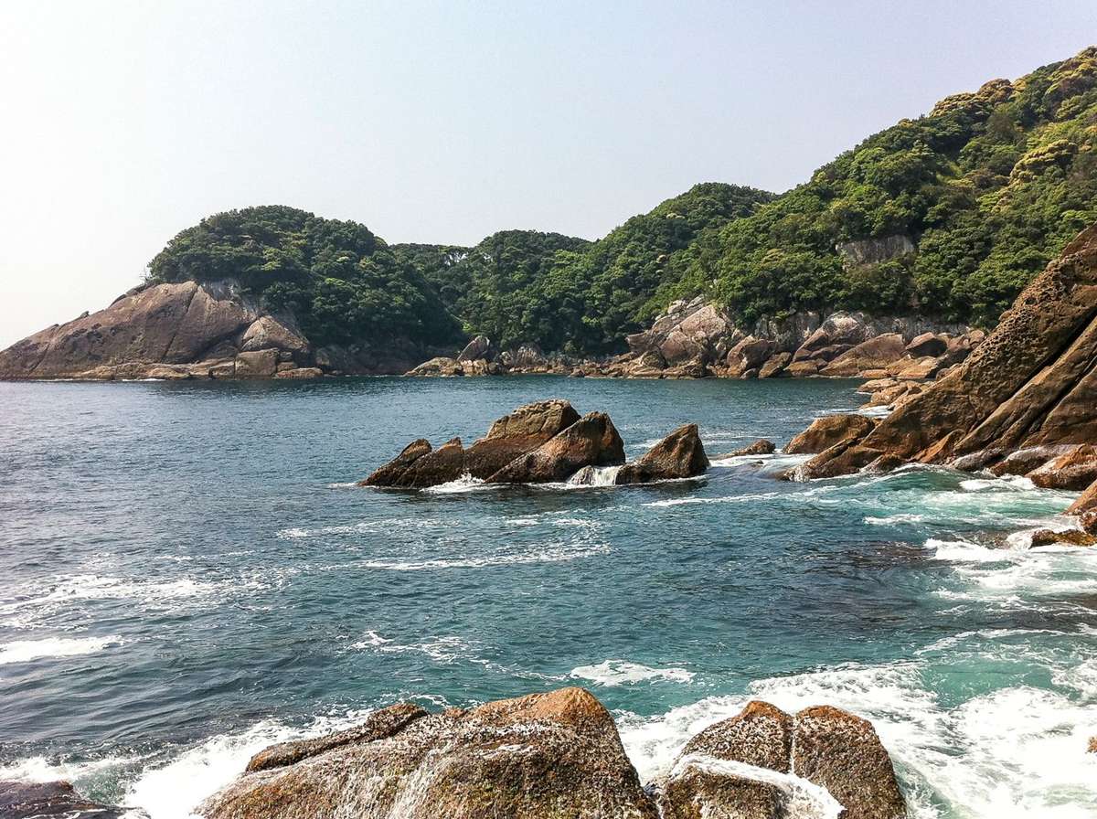
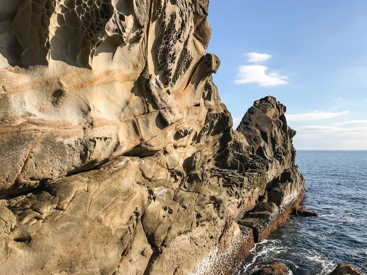
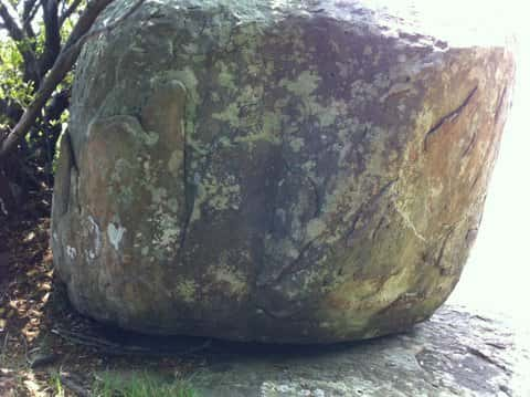
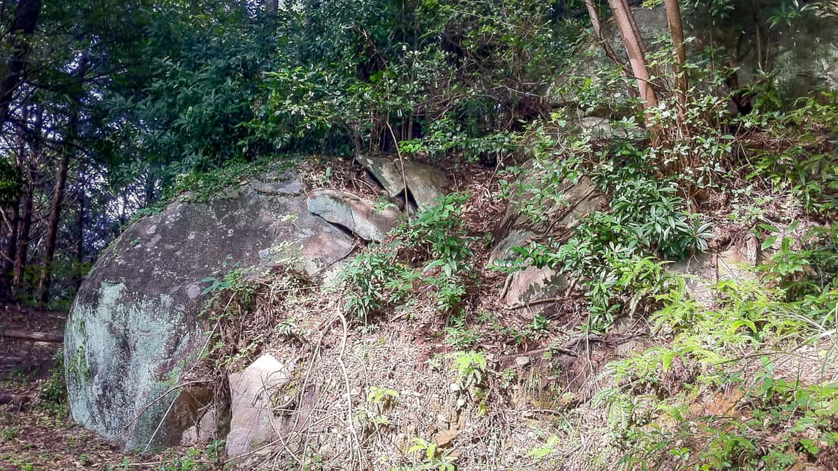
The wharf of Takegashima is supported by a spread of geological formations called the Shimanto belt strata, which are distributed not only in the south of Shikoku but also along the vast Pacific coast from Kyushu to the Kanto region. The strata are formed by turbidites, which are sediments on the seabed that flow like landslides. Turbidite is thought to be formed by a collection of accretions that detach from rocks when oceanic plates move under continental plates. On Takegashima Island, alternating mudstone and sandstone layers made by turbidite can be seen throughout the edges of the island. On the eastern shore of Takegashima, which was nurtured by these Shimanto Belt strata, large boulders rose from the water and revealed what appeared to be megaliths.
The quay of Takegashima
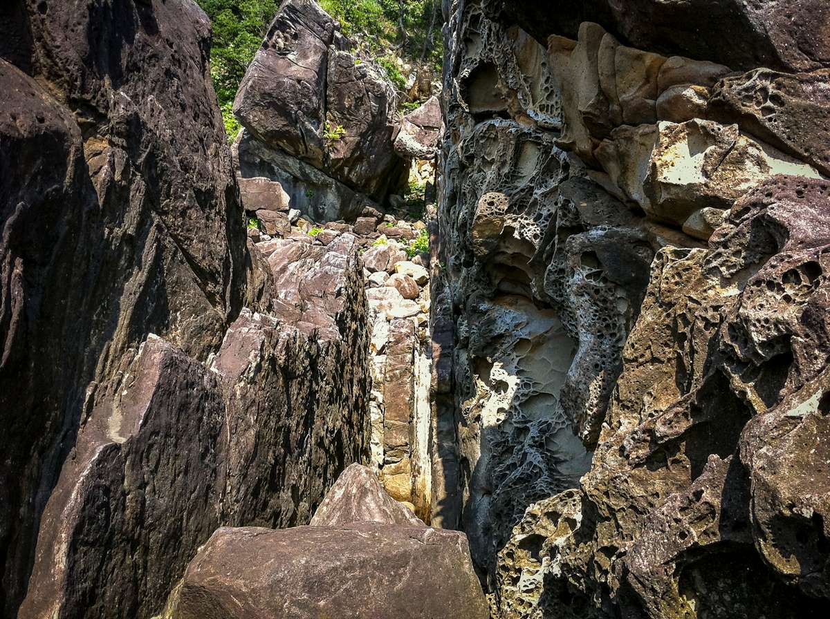
The unique rocky landscape of TakegashimaThe unique rocky landscape of Takegashima Island in front of Takegashima is quite different from the smooth coastline that continues from Cape Muroto, creating an appearance of an island formed by megaliths worthy of being called “Iwa-no-shima” or “rock island”, so sailors traveling by boat in the nearby seas must have been able to see it at a glance. Megaliths like the ones found on the east coast of Takegashima Island and turbidite formations are not usually found on the ship route from the Nansei Islands to Awaji Island, nor has another island been found that has megaliths like Takegashima. Therefore, it is thought that Takegashima, which is on the way north from Cape Muroto to Awaji Island, has come to be revered as a holy island.
The History of Takegashima
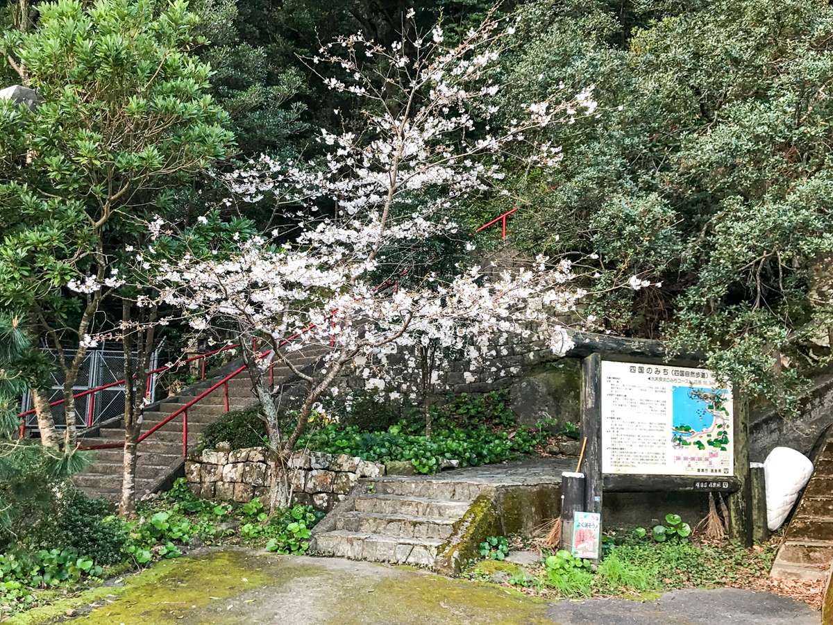
The Shikoku-no-Michi trail during SpringAs the ship routes from Cape Muroto to the outskirts of Awaji Island increased, settlements gradually developed along the Pacific coast of Kochi and Tokushima, and people began to build villages in these new areas. In ancient Japanese society, there is evidence that high-altitude settlements were scattered around the Seto Inland Sea, and Shikoku was no exception. Villages started flourishing at the mouth of the Kaifu River. The development of villages centered on the Kaifu River also led to high-altitude settlements being built in the upper reaches of the river flowing there. The Kaifu River runs from East to West in Katsuura County north of Naka District, through Mt. Kumohaya and Mt. Takagi, to the foot of Mt. Tsurugi.
Just before reaching the seaport which served an important position as a halfway point connecting Cape Muroto with Ishima and Awaji Island, Takegashima immediately stands out in the ocean . It is a rocky island close to Kaifu seaside town and overlooks the Pacific Ocean, so this geographically important place must have a long history that goes back to ancient Japan. This is most likely why festivals like the Marine Mikoshi Festival are still being celebrated today. Rocks were considered sacred in Japan long ago, and people worshiped them as if they were their God. Therefore, Takegashima is full of beautiful large megaliths where people performed holy rituals in ancient times. Even today, we can see traces of these ancient people’s faith through the Marine Mikoshi Festival and the existence of the God in the Holy Rock at the top of the cliff. Unfortunately, the history of Takegashima is now considered lost because there is no mention of it in historical documents. However, even with its unique position, the importance of this landmark for seafarers must have been known by scholars for a long time.
View of the Pacific Ocean from
the top of the Takegashima smoke towerSailors sailing northward along the coast of Muroto from the southern Pacific Ocean used Takegashima Island as an important landmark since it was at the halfway point going to the Kii Channel. From the summit, the Pacific Ocean was not only crystal clear, but Cape Muroto to the south was also visible along with the Kii Channel to the northeast, and the Kumano Mountains to the east. Therefore, Takegashima must have been an important observatory for the ancient Japanese settlers on the island. Hundreds of years later, smoke signals became one of the main forms of communication. Historically, the Takegashima Distant Lookout Point was officially established in 1807 (4th year from the Bunka Era), and it became known as the main base for its Smoke Signal Tower.
The purpose of the smoke signal tower on Takegashima Island was to alert the villagers about shipwrecks, and invasions or attacks by a foreign ships. Viewing stations that used smoke signals as a form of communication were called the “Distant Lookout Point” that stretched from the Pacific coast of Shikoku to the Kii waterway, and Takegashima was the first of dozens of lookout points that became well-known. Therefore, it seems that the flatlands in the northern part of the island must have been inhabited since ancient times. In the more recent past, it has been recorded that 16 people moved to the island in 1847, and by 1854 50 houses were built on the island.
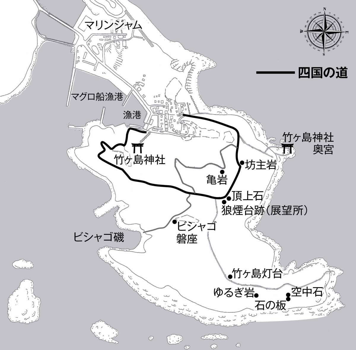
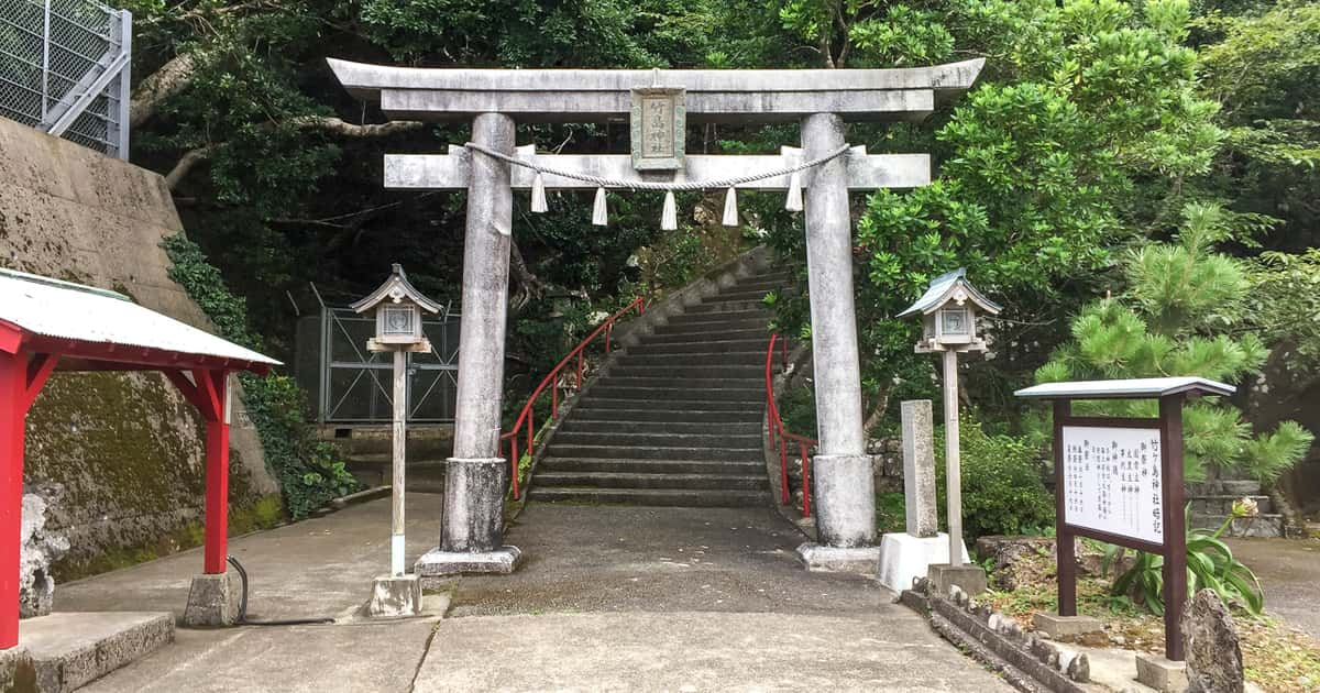
Map of TakegashimaIn modern times, Shikoku Road was built throughout Shikoku and this foot path connects to Takegashima. Shikoku Road starts from Takegashima Shrine near the fishing port, passes through the top of the mountain, continues around the island, passes through the inner shrine of Takegashima Shrine, and then returns to the fishing port. The area facing the fishing port and the inland on the west side of the walking path is about 30% of the entire island and is today owned by Kaiyo Town. The area outside the walking path facing the Pacific Ocean was owned by the Takezaki Family. This family was most likely descendants of the settlers who were in charge of the Smoke Signal Tower until recent years.
Takegashima Shrine
The Giant Rock that became Takegashima
In ancient times, the relationship between nature, gods, and humans was considered to be important for the people living in Japan. Immigrants from the Asian mainland took an important role behind the scenes in building ancient villages on these Japanese islands. Religion and the idea of God most likely were brought over by the ancient immigrants of Israel who came by way of West Asia. In the 7-8th century BC, the Israelites lost their nations to invasion, and after these pivotal historical events, some of those immigrants came to the Japanese islands and contributed to the foundation of the nation.
For those immigrants who came from Israel in West Asia, the rock was also considered to be a symbol of God. In fact, the Israelites have been using the word “tsu” which literally means “rock” to refer to “God” since ancient times. The rock was thought to be a god. Therefore, the rocky island that suddenly appeared from under the sea brought a lot of attention from these immigrants.One of these giant boulders along the eastern sea coast was considered to be holy and it became a place of worship. The tradition of the holy rock continued to be a place of worship for generations. In this way, Takegashima eventually came to be known as an ancient sacred holy ground, or an island of “rock”, due to its unique nature as a rocky island.
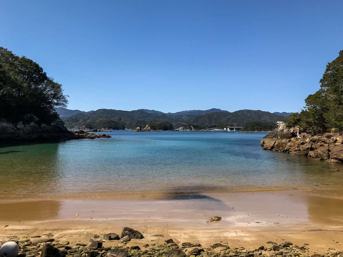
Uraiso, where the festival of
Takegashima Shrine is heldThe history behind Takegashima Shrine is uncertain, but the local lore that remains tells of a ship in distress that was rescued by the gods. The story says that on one stormy night off the coast of Takegashima Island, a ship in distress saw a light in the distance, and relied on it as a guide to reach the shore safely. The islanders then built a small shrine on the giant boulder behind Uraiso and enshrined it. According to legend, this area was the possible foundation of Takegashima Shrine. Therefore, this story is why islanders wish for the safety of the fishermen while they are away and they pray for a good catch on any day. The people of Takegashima gather at the rocky shrine on the east coast of the island and pray for God’s protection there. Generations later, Takegashima Shrine was built in its current location.
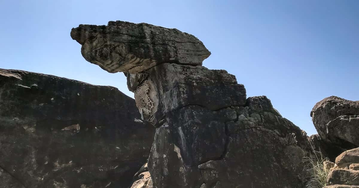
The Rock God dwelling on
top of the boulder in TakegashimaRegardless of the authenticity of this story of placing the sacred stone on the top of the Takegashima rock wall, there is no doubt that the God of Takegashima Shrine is the huge boulder standing on the Pacific coast facing the eastern part of the island. These huge boulders featuring unusual shapes are lined up in three rows which can be seen from the distant sea. The majestic shape and size is unheard of even in Japan, and at the top of the wharf of the center boulder lies a megalith to symbolize the placement of the deities. Considering the position and shape of this megalith, it seems somewhat unnatural to think that this was a work of nature. Rather, it is thought that this megalith was placed on the top of a rock by human hands in ancient times as a sacred seat for performing ritual activities. That place became the sacred shrine of Takegashima, and many people have since gathered at the top of the wharf to worship the god.
Hundreds of years later, a holy man named Kukai, also known as Kobodaishi, was born and raised in Sanuki,Shikoku and he experienced his spiritual awakening at Cape Muroto at the age of 19. He must have noticed the existence of Takegashima floating along the east coast of Shikoku while traveling to the cape.The majestic island can be easily seen just by sailing along the coast by boat. Just by coming to Takegashima island, visitors can take in the ritual sites that have been there since ancient times, and visitors can learn the true value and importance of Takegashima’s existence.
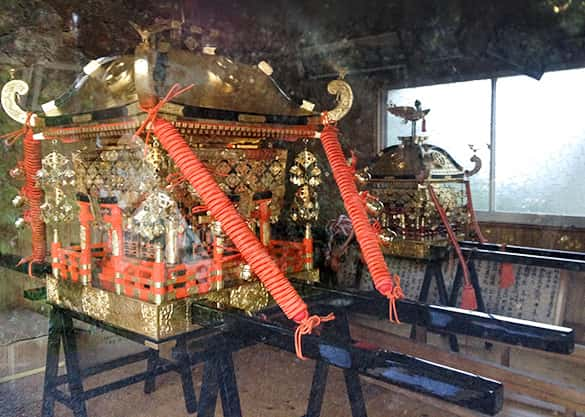
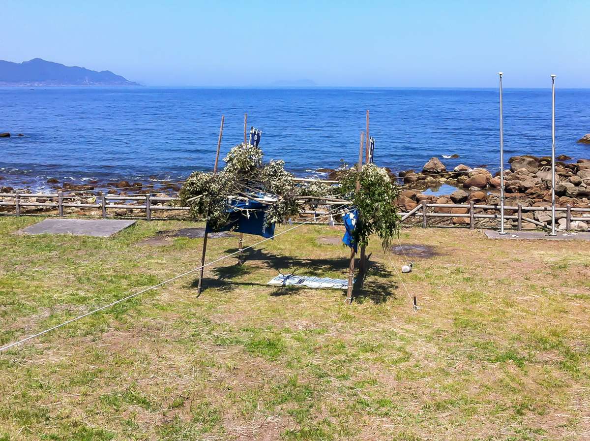
An event called “Hama-ire” ,the rampaging mikoshi, is held every year on April 16th of the lunar calendar. A crowd of people carry the mikoshi to Uraiso from the eastern area of the island and walk into the sea while cheerfully shouting “Cho-saja”. In order to receive blessings from the gods, all the people from the island, from the elderly to children, pass under the mikoshi. The Marine Mikoshi Festival or the Kaichu Mikoshi Matsuri, is a celebration in which the mikoshi, the portable shrine where the gods are said to dwell, are intentionally put into the sea because this ritual may have had an important religious significance. This mysterious ritual of walking across the sea while carrying a god has been handed down since ancient times. Today, due to the depopulation of Takegashima and the shortage of young mikoshi bearers, the Hama-ire event was canceled in 2017. Considering that the event has already been canceled six times so far, its continuation is in jeopardy. According to Mr. Shimazaki who serves as a town councilor of Kaiyo Town and is also the main representative of the shrine said, “Many people look forward to the island’s traditional events, and we are thinking about taking measures with other representatives and shrine priests so that we can continue to hold events next year.”
On Takegashima, the island floating in the South Sea, there is the Takegashima Shrine and the Okumiya shrine. The Okumiya shrine is an inner shrine of Takegashima Shrine and it’s in the eastern side of the megalith area. Both the Takegashima shrine and the Okumiya Shrine have been enshrined here since ancient times and they still to this day remain as unknown historical sights to most people outside of this area. Because Takegashima has a history full of dreams and romantic legends of the ancient past, we sincerely hope that this beautiful place will remain as an attractive destination to tourists forever.
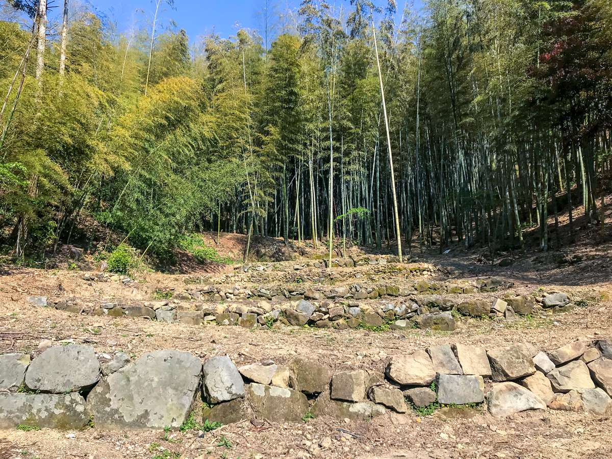
The Tiny Bamboo forest on Takegashima Island
Takegashima’s beautiful
bamboo forestAccording to the history of Shishikui Village written in the 12th year of the Taisho era (1923), the reason why the island came to be called Takegashima is because “In the past, the island was a full bamboo forest, and it was never cut down with an ax. Therefore, it came to be called Takegashima or “Bamboo Island”.
Examining the topography of Tokushima, one can easily find and see that there is a wide rocky area spread out at the base of the island, making the surface of the island look very jagged. Even though this island has an area of only 0.4 km², the altitude of the summit is about 100 m, making the slope quite steep.
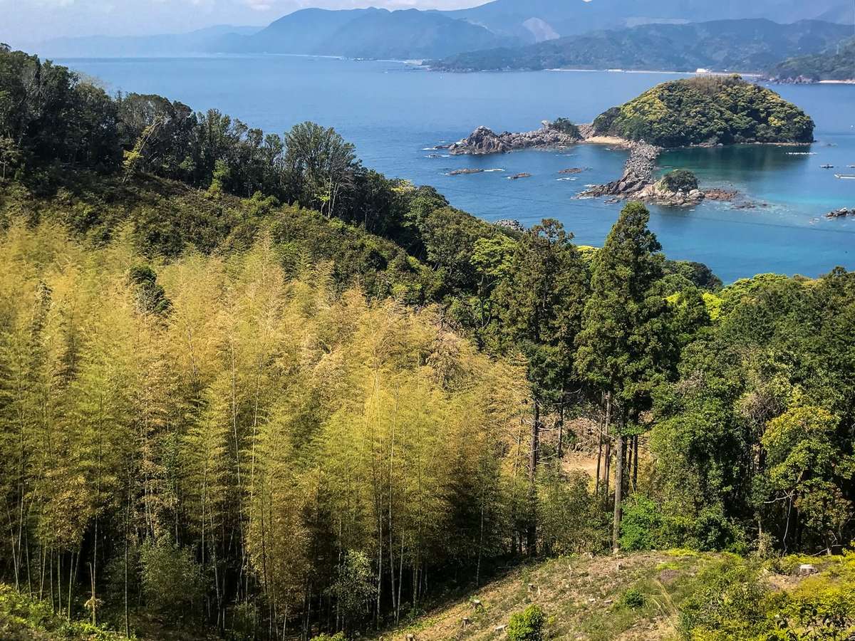
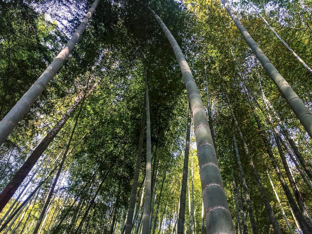
Overview of Takegashima’s bamboo forestTakegashima consists of two large uplifted layers of rocky hills from the ocean that connect from north to south to form one island, so its shape looks like a gourd. The beautiful bamboo forest is located in the center of Takegashima Island where the two hills meet like in the hollow of a gourd. Measuring 1 km from north to south and 700 m from east to west, the area of the bamboo forest is less than 100 m² in the center of the island. The beautiful bamboo forests are actually limited to only 50 m². Nevertheless, the thickness and appearance of the bamboo in the central bamboo forest is stunning, and they deeply stir the emotions of the visitors who come to the island.
From the southern part of Takegashima Island to the Pacific coast in the east, the rocky areas are spread out over the landscape, and the surrounding area is covered by countless rocks of various sizes. Rocks are exposed everywhere on the island making the slope very steep. Considering that this place is a tiny remote island in the Pacific Ocean, it is extremely unlikely that this bamboo forest grew naturally only in the center of this small island.
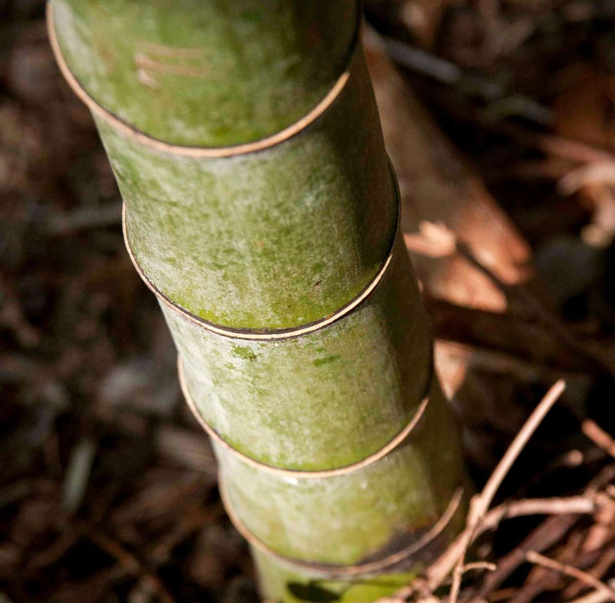
A Takegashima’s bambooRather, the bamboo forests of Takegashima were more likely planted by ancient immigrants from Asia since bamboo is not indigenous to Japan and it is common knowledge that bamboo came from mainland China. Thus, those immigrants were either Chinese or other world travelers from West Asia who came via China and eventually made their way to Japan.
Furthermore, the bamboo forest is fully grown only in the center of the island and bamboo trees are not likely to grow abundantly on an isolated island in the South Sea. Summit stones and stones that may have been used as compass stones served as indicators of direction in the north and south of the bamboo forest. Therefore, it is possible that the ancient wisdom of scholars from Asia worked and the bamboo trees were planted according to a proper master plan. The romanticism of Takegashima is about bamboo itself.
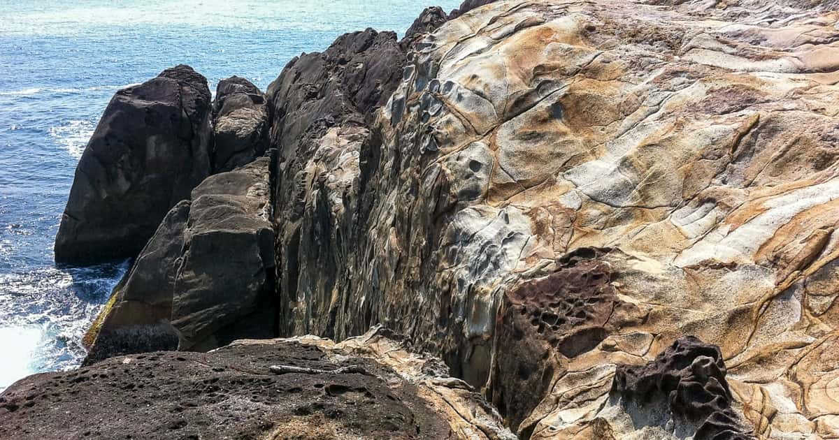
Takegashima Bishago Iso
Iwa Museum
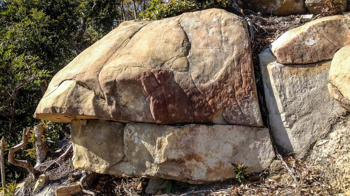
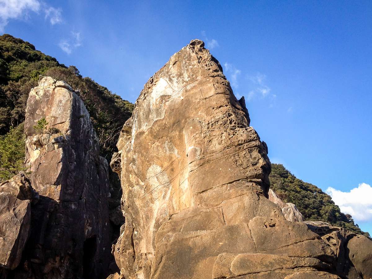
Takegashima Summit StoneTakegashima is also said to be called a “rock museum” because many of the rocks on the island display some unique shapes. First off, it is worth taking a look at the Takegashima summit stone that is located at the top of the island, right next to the observatory. If the weeds become too overgrown, the view is too difficult to see from a distance. But, the summit stone does in fact look like a beautiful hat worn by a monk. Whether the stone at the top of the island is really a product of nature is still unknown.
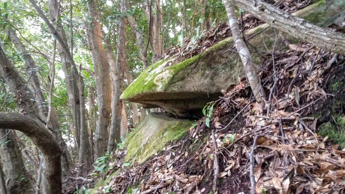
Bozu IshiTo the north of the Takegashima summit stone, there is the “Bozu Ishi” or the “Monk Rock” that looks like a huge stone in the shape of a monk’s hat. This Bozu Ishi hat looks similar to the summit stone at the top of the island. When viewed from the side, the megalithic hat protrudes about 30 cm further than the body of the megalith, and at a first glance, it seems to play the role as the protective upper lid of the entire megalith with its base almost parallel to the ground. This Bozu Ishi site is along Shikoku Road and may have been a base for ancient settlers’ rituals.
Firstly, It should be noted that this place is located directly above the Iwakura, the sacred rock of Takegashima Okumiya Shrine. Straight up the steep slope from the inner shrine along the coast, is the Bozu rock. Directly below the Bozu rock are stones that have been laid out in a large circle within a diameter of about 3 meters. It is not known for certain whether this circle of rocks naturally formed the shape of a circle or it was intentionally arranged by human hands. In any case, since this circle of rocks is near the top of the island, it is considered to be a megalith with a key position as an ancient ritual site.
Takegashima’s “Turtle Rock”Going down the stairs of the Shikoku Road walking trail from the Takegashima Bozu Rock and then west, there is the humongous “Kameishi”, or “Turtle Rock” on the side of the road. At first glance, it looks like a nondescript megalith, but the rocks with a smooth surface draw a beautiful arc and are connected to two other slabs of rock. There are also megaliths across the path and countless small rocks are piled up under the steep slope, indicating that this is the site where the rocks were cut down. In order to cut harder rocks such as granite, the ancient islanders used to hammer arrowheads into the rocks to break them. By examining the traces of arrows left on the rock, it is possible to roughly guess the time when the rocks were cut. Many of the rocks on Takegashima seem to indicate that they were dated between the Toyotomi Hideyoshi and Tokugawa periods based on the traces of arrows left on the rocks. The rocks on the island continued to be cut down until modern times, and these rocks were also used for the maintenance and the development of the island.
Takegashima Yurugi Rock
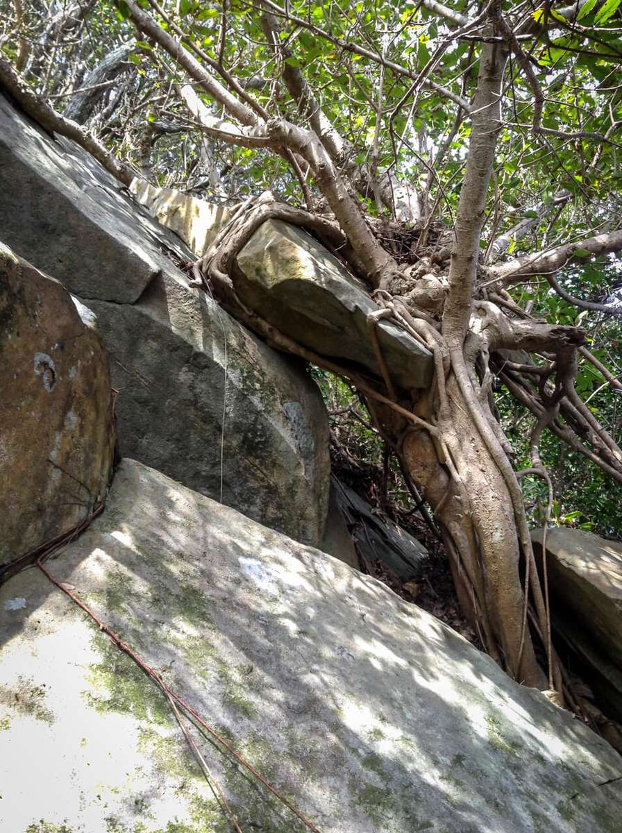
In the south of the island along the Pacific coast, many rocks are scattered, and rocks of various sizes formed the base of the island. What is particularly eye-catching is the “Yurugi Rock” or the “Swaying Rock” of Takegashima, which sticks out like the point of an arrow and is suspended in the air with a shape equivalent to the “Yurugi Rock” of Mt. Gozaisho. This could be a miraculous work of nature and not man-made. To the east of “Yurugi Rock” are the “floating stones” that are carefully cradled by tree branches, and directly below them are “stone slabs” that became part of the tree while they were leaning against it. The floating stones were crystallized by the power of nature in a way in which the surface of the stone slid off from the rock suspended by the trees so that they appear to be wrapped by branches.
Let’s protect the natural habitat and the traditions of Takegashima!
Iwakura, or the “Holy Rock”, which is found in the inner shrine of Takegashima Shrine, still remains as a venerable sacred monolith to this day. With this monolith Takegashima continues to emit a glorious aura in the great nature overlooking the Pacific Ocean to this day. However, some practical problems are hindering the preservation of the nature of the island
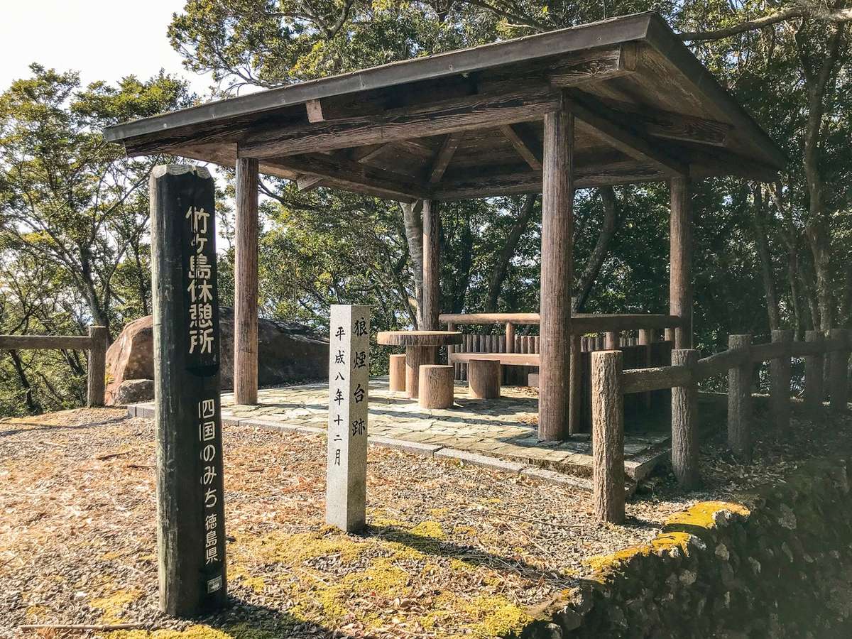
Takegashima rest area (the summmt
of Takagegashima) Signal tower siteThe area around Takegashima, which is on the border of Tokushima and Kochi prefectures, is going through depopulation, and like other towns in Kochi and Tokushima prefectures, the wave of the declining birthrate and aging population is accelerating. At this rate, the population of the island could fall to zero in 20 years. The number of tourists visiting Takegashima has already plummeted sharply, and nowadays there are often days when no tourists walk along Shikoku Road on the island. Marine Jam, operated by Kaiyo Town, has also seen a decrease in the number of visitors, which has caused a major financial blow to the government. If people do not visit the island, Shikoku Road will not be maintained, and it will continue to fall into disarray.
Takegashima 7 steps Sacred AreaSince Takegashima is located in what is called a quasi-national park, Tokushima Prefecture has the responsibility of maintaining the island. However, the whole area of the quasi-national park is large, and Tokushima Prefecture does not have the budget nor the leeway to maintain the unvisited island. So unfortunately, Takegashima Island has been neglected for many years, and as a result, until just a few years ago, the island looked like a wild jungle. Shikoku Road was blocked by fallen trees, dead trees, and falling rocks. Trees were cut down arbitrarily and tree trunks were left everywhere. Since the entire island turned into a jungle covered with weeds and vines, it became a home for insects and snakes. The island has changed for the worse and it has become far from the beautiful island that people used to visit with peace of mind. In addition, the area around the summit has also not been maintained for many years, and as a result, the ocean view is completely blocked at the top of the summit even though the summit was the historic ruins of the Smoke Tower that was used to as a lookout over the Pacific Ocean.
Needless to say, urgent action is necessary to protect the exquisite nature of Takegashima and its sacred grounds. The island must be an environment where people can visit without fearing for their safety. Remeditive action must be implemented quickly regardless of whether it is done by the government or by the private sector. In order to make this conservation a reality, everyone must first learn about the splendor of Takegashima Island and understand the existence of its venerable history.
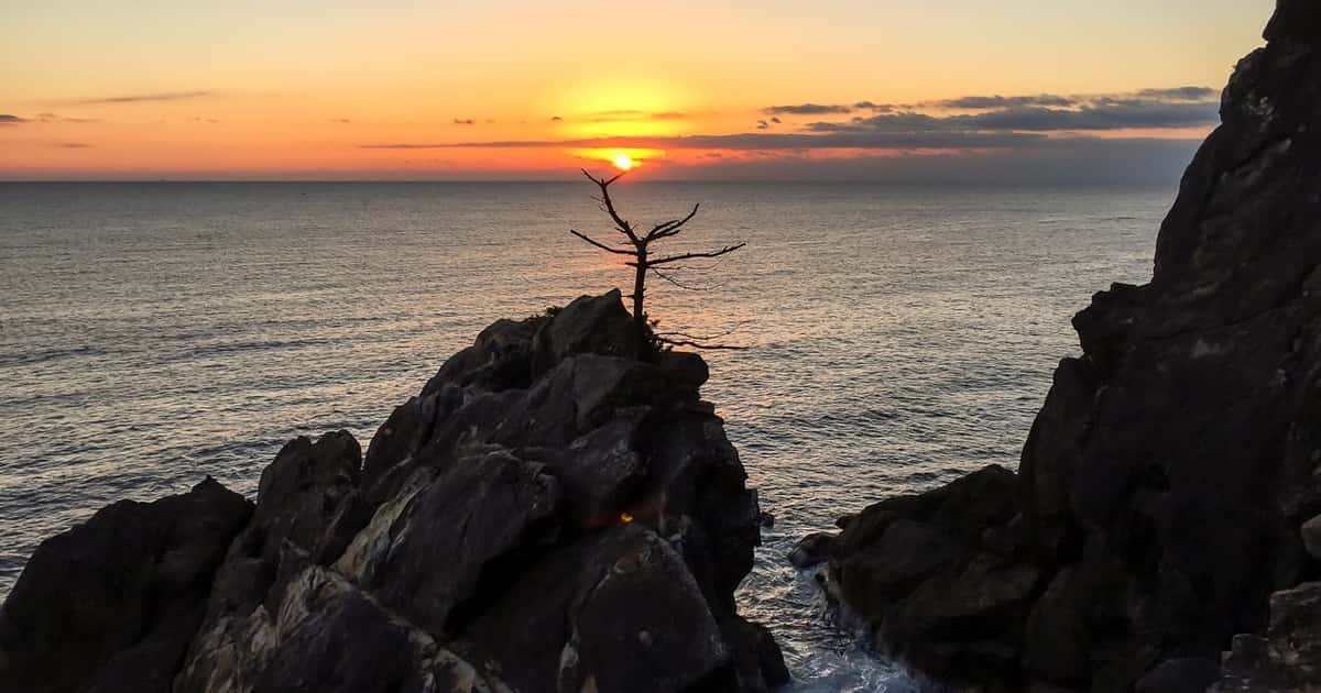
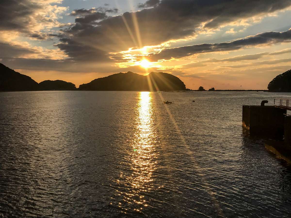
Sunrise on New Year’s Day in Takegashima
You may also like this site